

Why Is Panama So Important? 15 Facts to Understand the Country and Consider Moving Here
Panama matters far more than its size on a map might suggest. Its formation changed ocean circulation, its territory hosted a Scottish venture with lasting historical consequences, and its railroad connected the Atlantic and Pacific before the United States completed its famous transcontinental route.
The Canal is its best-known symbol, but it is only part of the story. From its distinctive shape as an isthmus to its appeal for people looking to live abroad, these 15 facts about Panama help explain why this small country plays such an important role in the world.
Adapted from the transcript of Why Everyone Misunderstands Panama, by Geography By Geoff. We follow the same topic order, with factual clarifications and context for this publication.
1. Panama: a country built on a land bridge
Panama’s geography is remarkable. Much of its territory forms an isthmus: a relatively narrow strip of land connecting two larger land masses.
Here, the bridge joins North America and South America. To the east and southeast lies Colombia, leading into the rest of South America. To the west is Costa Rica, followed by the rest of Central and North America. The Caribbean Sea and Pacific Ocean lie on opposite sides of the isthmus.
This location made Panama a major transportation corridor. People, goods and ideas have crossed its territory for centuries. Its geography helps explain why so many powers and merchants took an interest in this place long before the Canal was built.
2. You can see two oceans from Volcán Barú
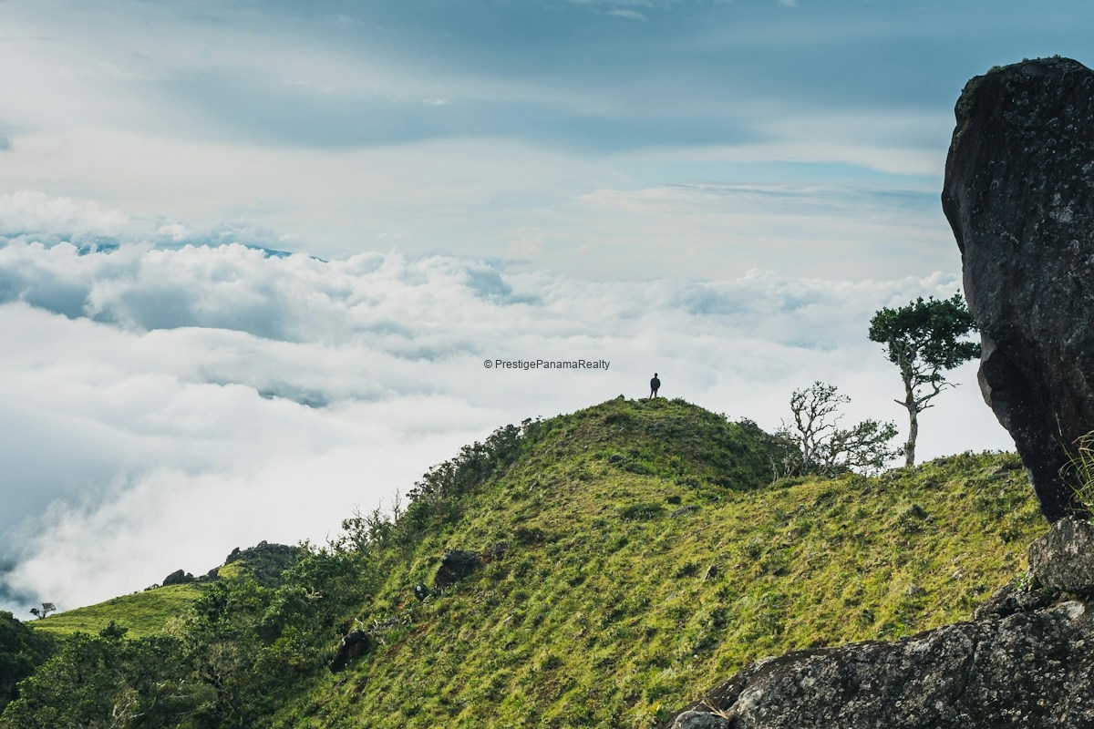
The country’s narrow shape has a fascinating consequence: under the right conditions, you can see the Pacific and Caribbean from a single viewpoint.
That place is Volcán Barú in Chiriquí, Panama’s highest point, at approximately 3,474 meters (11,397 feet) above sea level. On a clear day, visitors who reach the summit can enjoy this exceptional view.
The ascent requires preparation. It is a mountain route with steep slopes, uneven terrain and conditions that can change along the way. Guided hikes and specialized vehicle excursions are available; arrange your visit with authorized operators and check access conditions.
The official guide to Volcán Barú National Park describes this landscape, one of Chiriquí’s most striking settings.
3. Panama’s formation influenced the planet’s climate
Millions of years ago, the territory we now call Panama was not a continuous land bridge. A marine passage connected the Atlantic and Pacific.
Over time, tectonic activity raised the isthmus and eventually closed that connection. Ocean circulation was reorganized, with important changes to ecosystems on both sides.
The video connects this process to warm Atlantic currents and their influence on Europe. The science needs some nuance: the isthmus altered currents and global climate, but saying Panama alone “created Europe” simplifies a much more complex story.
The Smithsonian Tropical Research Institute explains how this bridge changed the planet and allowed species to move between North and South America. Panama’s importance began long before maritime trade.
4. A bridge between continents without a continuous road
You might imagine that a country between North and South America would have a highway linking them without interruption. However, the road connection between Panama and Colombia is broken by the Darién Gap.
The network of routes associated with the Pan-American Highway stops in this region of forests, rivers and difficult terrain. There is no continuous road allowing you to drive directly from Panama to Colombia.
Connection projects have been debated over the years, facing engineering obstacles and environmental, health and social concerns. Darién reveals an apparent contradiction: Panama is a geographical bridge between continents, but that bridge is not a road you can drive from end to end.
5. Panama is also a country of islands
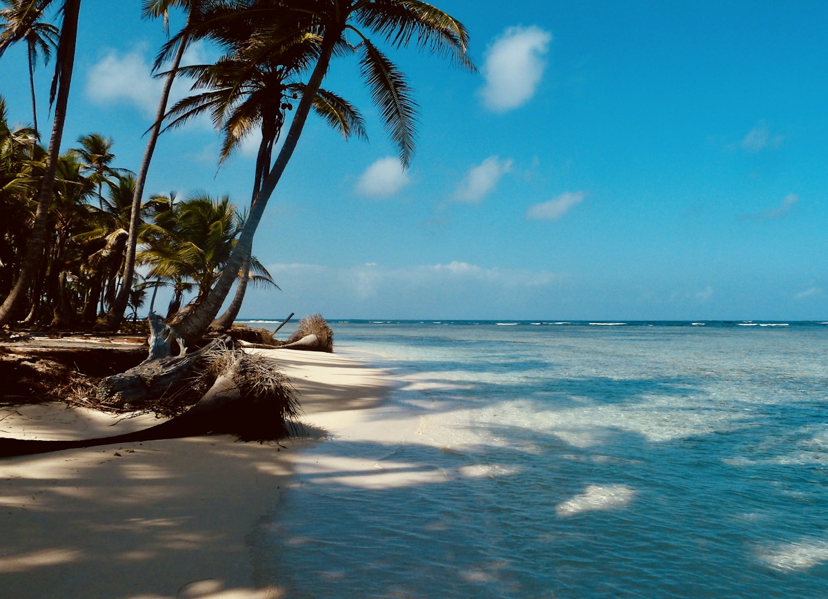
When we think of Panama, we often picture a strip of land. Yet its coastlines are surrounded by a remarkable variety of islands, in both the Caribbean and Pacific.
The video mentions approximately 1,400 islands and highlights the archipelagos of Guna Yala, also known as San Blas, and the Pearl Islands. There are also islands of great ecological significance, such as Coiba, and destinations close to the capital, such as Taboga.
Some are small and little known; others are home to communities, marine landscapes and visitor experiences. This island dimension broadens our understanding of the country: Panama has mountains, forests, cities and an extensive coastal and island life.
Explore its destinations and plan a visit using Panama’s official tourism guide.
6. Its railroad crossed the isthmus before the famous US route
The United States often gets much of the attention when people discuss transcontinental railroads, because of the connection completed in 1869. But Panama already had a railway between the Atlantic and Pacific in 1855, fourteen years earlier.
The difference was scale: the Panamanian route was roughly 47 miles, or 76 kilometers, long. It was much shorter than the extensive US route, but served a crucial purpose: moving people and goods across the isthmus without sailing around South America.
During the nineteenth century, this connection made Panama a vital part of travel and trade between oceans. The history of the Panama Railroad documents the scale of the project and its construction challenges.
7. A failed colony in Darién left its mark on Scottish history
One of Panama’s most surprising historical connections involves Scotland.
In 1698, a Scottish expedition attempted to establish a colony in Darién and create a trading center benefiting from passage between oceans. Known as the Darién Scheme, the project aimed to open a strategic route for international trade.
The venture failed through a combination of poor planning, disease, supply difficulties and Spanish opposition. By around 1700, the settlement had been abandoned.
Losses were significant for Scottish investors and became part of the economic and political context surrounding union negotiations with England. The Kingdom of Great Britain was formed in 1707. Panama was not the sole cause of that union, but the failed Darién Scheme played a significant role, as discussed in the economic history examined by the UK Parliament.
8. Separation from Colombia and the Canal are closely linked
Panama separated from Colombia in 1903. US interest in building an interoceanic waterway and its support for the separatist movement are essential parts of that context.
The Hay–Bunau-Varilla Treaty was signed that year, granting the United States extensive powers over the zone designated for the Canal. Panamanian representation in that negotiation has been a subject of historical debate.
The country secured its separation from Colombia while a strategic part of its territory came under the Canal Zone regime. Decades later, the 1977 Torrijos–Carter Treaties established the transfer process.
On December 31, 1999, Panama assumed administration of the Canal. To distinguish these agreements and dates, consult the Panama Canal Authority’s official history.
9. Portobelo was a key part of colonial trade
During the colonial period, Spain needed to transport wealth extracted from its American territories to Europe. The isthmus provided a route to move goods from the Pacific to the Caribbean.
Portobelo, founded in 1597, became an important point in that trading system. Its fairs and port were linked to the movement of silver and other goods onward to Spain.
That concentration of wealth also made it a target. During the seventeenth and eighteenth centuries, privateers and foreign forces attacked the area.
Today, its fortifications and cultural heritage reveal another chapter in Panama’s international importance. Long before modern cargo ships, the isthmus already held a strategic position in the movement of goods.
10. Building the Canal required transforming an entire landscape
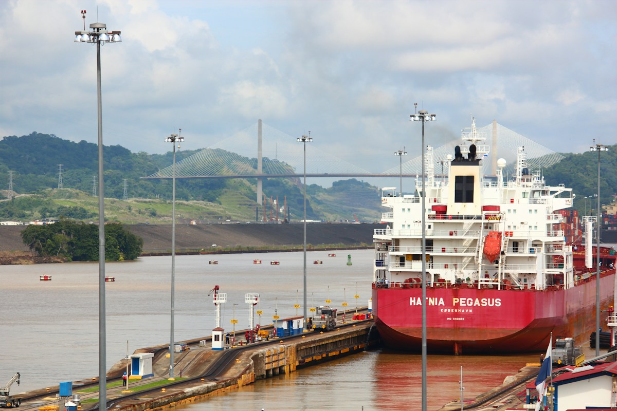
The short distance between oceans did not make the Canal easy to build. The project required massive excavation, river works, reservoirs and enormous locks.
The locks work as water elevators, raising and lowering ships so they can cross the isthmus. The route uses Gatún Lake and passes through the Culebra Cut, one of the project’s most challenging sections.
The French began a construction attempt in the nineteenth century. The United States resumed and completed the project, which opened on August 15, 1914.
There was also a profound human cost. Disease, accidents and difficult conditions affected thousands of workers. The Canal’s history includes both its engineering and the efforts and losses of the people who made it possible.
11. Water is one of the Canal’s greatest challenges
It may seem surprising that a tropical country could have water difficulties affecting a maritime route. But the Canal depends on fresh water from its watershed and reservoirs to operate the locks.
When rainfall decreases and lake levels fall, operations must be adjusted. This can affect transit slots and conditions for ships, with consequences for global trade.
The transcript places a drought crisis in 2026. For this adaptation, we use the episode documented by the Canal Authority in 2023 and 2024, associated with the dry season and El Niño, which led to restrictions and water-saving measures.
The official explanation of water availability shows why the watershed matters for both the Canal and the population’s water supply.
12. Many of the world’s ships sail under Panama’s flag
Panama has a maritime presence far greater than you might expect from a country of its size. Its ship registry allows many vessels owned by foreign operators to sail under the Panamanian flag.
This does not mean all those ships were built in Panama, belong to Panamanians or regularly pass through the Canal. The flag identifies the state under whose registry a vessel operates.
The video explains this presence through the registry’s appeal to the shipping industry. Its figures change over time, so we retain the central point here: Panama is an important player in international ship registration.
The Panama Maritime Authority describes the registration procedure and related services.
13. Indigenous comarcas are part of the country’s identity
Panama’s history and geography also find expression in its Indigenous peoples. Comarcas are territories with special arrangements for organization and autonomy within the Panamanian state; they are not independent countries.
The video highlights Guna Yala on the Caribbean coast and its people’s struggle to preserve their identity and forms of organization.
The Guna Revolution of 1925 was a key event in that process. Its history is a reminder that recognition of rights and autonomy emerged through conflict and negotiation.
Getting to know Panama also means learning about its living cultures, respecting each community’s rules and understanding that its cultural richness reaches far beyond the capital and the Canal.
14. Panama has the balboa, but uses the dollar in daily life
Panama’s official currency is the balboa, at one-to-one parity with the US dollar. Panamanian and US coins circulate in everyday life, while the banknotes used are US dollars.
For someone arriving from the United States, this makes shopping and comparing prices easier without needing to exchange currency for ordinary transactions.
The dollarized system also has economic consequences. Panama does not issue the dollar or determine US monetary policy. This is one of the distinctive features of its economy.
The Superintendency of Banks of Panama explains the relationship between the balboa, the dollar and the development of the banking center.
15. A destination attracting people who want to live abroad
The video ends with an aspect especially relevant to those considering a move: Panama as a destination for foreign residents, including people from the United States and Canada.
The climate, use of the dollar and opportunity to find different lifestyles help explain that interest. Some people seek retirement near the sea, others prefer the mountains, and others want an urban setting.
The transcript also mentions the territorial tax system and immigration options. These need individual review: receiving payments from a foreign company does not by itself determine the tax treatment of work performed from Panama. The source of income, activity and obligations in other countries should be reviewed with a professional.
When planning a move, verify the immigration category applicable to your situation with the National Immigration Service. Then compare destinations, housing and actual expenses based on your routine.
In Chiriquí, you can explore David, Boquete, Tierras Altas and coastal communities. To begin with a city that can serve as a base for discovering the province, read our guide to moving to David for the first time.
Panama: a gateway to the world and a new chapter
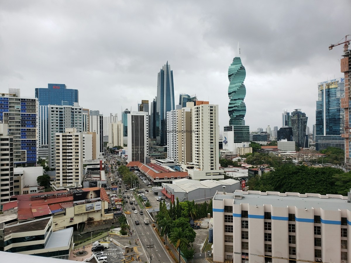
Panama joins two large land masses and provides passage between two oceans. Animals, travelers, wealth and goods have moved through its territory. Its history connects natural processes spanning millions of years with decisions that transformed international trade and politics.
Understanding why Panama is important means looking beyond the Canal. And if you are thinking about moving to Panama, learning that history can be the first step toward discovering which part of the country you want to call home.
Would you like to find your home in Panama?
At Prestige Panama Realty, we help you explore properties based on your budget, location and lifestyle. Tell us whether you want to buy or rent and when you plan to move.
You are our priority.
You can also contact us on WhatsApp.


